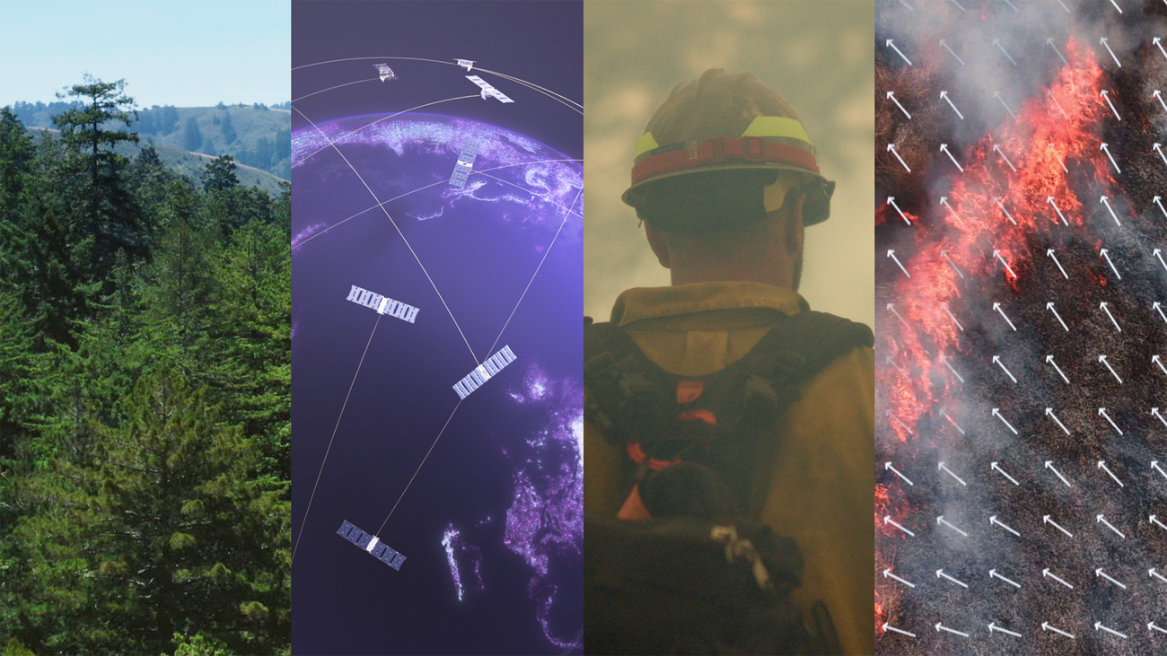
FireSat’s Satellite Network Enhances Wildfire Management
In a bold move, FireSat’s satellite network is set to redefine wildfire management. With over 50 satellites planned by 2026, this initiative promises rapid updates and high-resolution imagery, crucial for effective firefighting. Backed by Google, FireSat’s advanced technology aims to address current monitoring limitations, offering a sustainable solution with solar-powered devices. This expansion marks a significant step forward in global wildfire response strategies.
- 🛰️ Satellite Network Expansion: FireSat plans to deploy over 50 satellites by 2026, enhancing global wildfire management capabilities.
- 📷 High-Resolution Imagery: Advanced imaging technology provides detailed views of wildfire activity, improving monitoring accuracy.
- 🌞 Sustainable Solutions: Solar-powered devices installed on trees ensure energy-efficient operations for wildfire alerts.
- 🤝 Google’s Backing: With Google’s support, FireSat aims to revolutionize wildfire detection and response strategies.
- 🚀 Successful Launch: The recent satellite launch marks a new era in wildfire detection, setting new standards for the industry.
Launch of FireSat Satellites for Global Wildfire Surveillance
– **Rapid Wildfire Updates**: FireSat provides real-time data for effective firefighting responses.
– **High-Resolution Imagery**: Advanced imaging addresses limitations of current wildfire monitoring.
– **Expanding Satellite Network**: Over 50 satellites planned by 2026 to improve wildfire management.

Google’s FireSat Satellite Takes Flight for Wildfire Oversight
– **Successful Launch**: FireSat satellite launched successfully, marking a new era in wildfire detection.
– **Google’s Initiative**: Backed by Google, FireSat aims to enhance wildfire monitoring capabilities.
– **Future Prospects**: The constellation promises improved response times for wildfire threats.
Muon Space and Google Introduce Satellite for Wildfire Control
– **Satellite Launch**: Google partners with Muon Space to deploy wildfire-monitoring satellite.
– **Remote Sensing Tech**: New satellite utilizes advanced remote sensing for wildfire detection.
– **Climate Impact**: Initiative aims to improve response strategies for wildfire management.

Dryad Networks Implements IoT for Early Wildfire Alerts
– **Innovative Technology**: Uses LoRaWAN mesh network for real-time wildfire alerts.
– **Sustainable Solution**: Solar-powered devices installed on trees for energy efficiency.
– **Industry Expertise**: Kaur engages telecom leaders for event speaker acquisition.